Industries from ecotourism to energy production to conservation groups need accurate and reliable location data to guide their growth and decision making. Students with expertise in GIS are starting great careers by gathering, analyzing, and presenting valuable geographic data.
Experience in Geographic Information Systems is in demand. Governments, NGOs, nonprofits, and small and large businesses need qualified professionals who can apply spatial analysis and data visualization skills to urgent issues. The Bureau of Labor and Statistics says GIS careers will expand much faster than the national average, with thousands of new jobs expected to be created in the next ten years.
Unity College offers students two ways to build their GIS skills. With a unique blend of environmental and GIS science, the Graduate Certificate in Environmental Geographic Information Science (GIScience) gives students broad experience in spatial technologies and environmental information. The certificate also prepares students for Unity’s 100% Online GIS degree program: the M.S. in Professional Science in Environmental Geographic Information Science.
Unity students are trained in the management and manipulation of data within the context of analyzing and interpreting environmental information. You’ll learn the art and science of big data visualization in a context that matters—environmental sustainability.
Online projects, research, and a capstone experience that focuses on solving a real-world environmental problem. empower students to blend theory with practice. This practical experience enables Unity graduates to become leaders in their field.
With skills in GIS, students have access to a host of challenging and rewarding career paths.
Environmental Conservation & Land Management
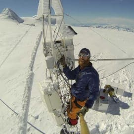
GIS originated in the 1960s as a conservation tool that gave land managers accurate details of watersheds, wildlife habitat, and agricultural areas. GIS careers in conservation are still abundant.
Geographers and cartographers use GIS to site new conservation areas and locate spots for renewable energy projects. Biologists and environmental scientists use a background in GIS as part of their data collection and to evaluate conservation efforts.
Conservationists need GIS data to manage delicate ecosystems. You might work with NGOs that manage lands spanning international borders and rely on spatial technology skills for land-use management. GIS plays a critical role in defining wildland areas so planners can make the best use of available resources. In countries with emerging economies, geographic information is necessary to balance development with the need to preserve the natural environment.
Public Health Geography
Public health is an interdisciplinary effort to keep our communities healthy and free of disease. Health officials look to GIS experts for vital information when making life and death decisions.
Our health and wellbeing are intricately linked to our surroundings. To combat disease outbreaks, officials must approach the problem from both geographic and cultural contexts—and GIS lends critical support by analyzing both location and environmental data.
With GIS, experts can make evidence-based decisions on where to place health care centers, and they can better grasp the impacts of public health policy. GIS also supports the analysis of broader long-term health trends in a population.
Unity’s courses like Modeling Our Changing World (GISC 605) teach students to analyze real-world environmental science problems. As the climate continues to change, health patterns will shift along with it, and understanding these issues in an interdisciplinary way will lead to innovative solutions.
Urban Planning
GIS improves the sustainability of our cities by helping us make smart decisions. Urban planners need a deep understanding of our built environment to minimize the impact of our cities and towns.
GIS professionals can find many career opportunities designing our human habitat—whether that’s studying traffic patterns and mass transportation, surveying new housing developments, or analyzing the interaction between cities and their natural surroundings.
From a business perspective, expertise in urban mapping helps retailers find new locations, understand consumer habits, and develop more sustainable supply chains.
GIS has many interdisciplinary applications, and Unity graduates have the skills and knowledge to create careers that combine an appreciation for environmental conservation with high-tech data gathering, management, and analysis. Students with GIS expertise will be a big part of designing our future.
Ready to take the next step in your career in Environmental GIScience?
Contact a member of our Distance Education Concierge team at: (207) 509-7155 or online@unity.edu.