About the Researcher
Shanell Bosch
MPS in Marine Science
Research Focus
Mapping and modeling stony coral habitat across the West Florida Shelf using GIS to identify data gaps, potential refugia, and priority areas for conservation and restoration.
Background
“I chose this project to directly support applied marine conservation efforts by combining my background in environmental planning and GIS with my graduate training in marine biology, producing tools that can inform real-world management and resilience strategies.”
Why I Chose Unity
“I chose Unity because of its strong emphasis on applied, sustainability-focused education and its flexibility in allowing students to design capstone projects that align with their professional goals. Unity’s hands-on, interdisciplinary approach allowed me to integrate science, GIS, and conservation planning in a way that directly supports my career in environmental and marine resource management.”
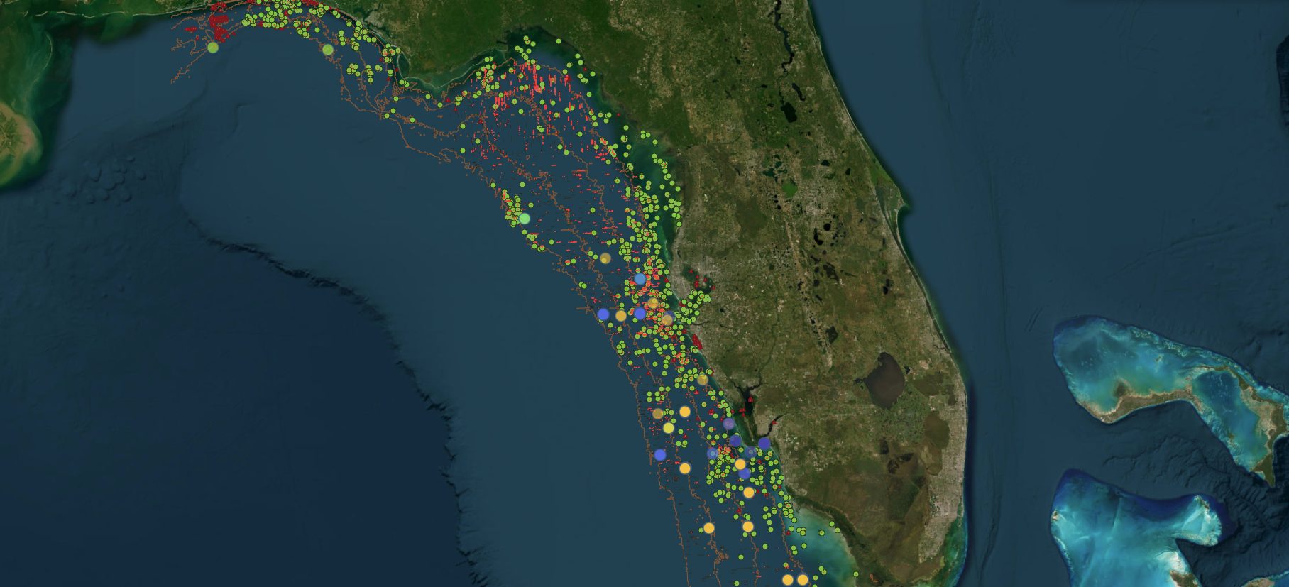
Mapping and Modeling Stony Coral Habitat Across the West Florida Shelf
The Challenge
Stony corals are foundational species that support reef ecosystems, fisheries, and coastal protection, but many Gulf of Mexico coral habitats remain undocumented. The West Florida Shelf is especially underrepresented in coral mapping and genetic conservation initiatives, including Mote Marine Laboratory’s International Coral Gene Bank (ICGB).
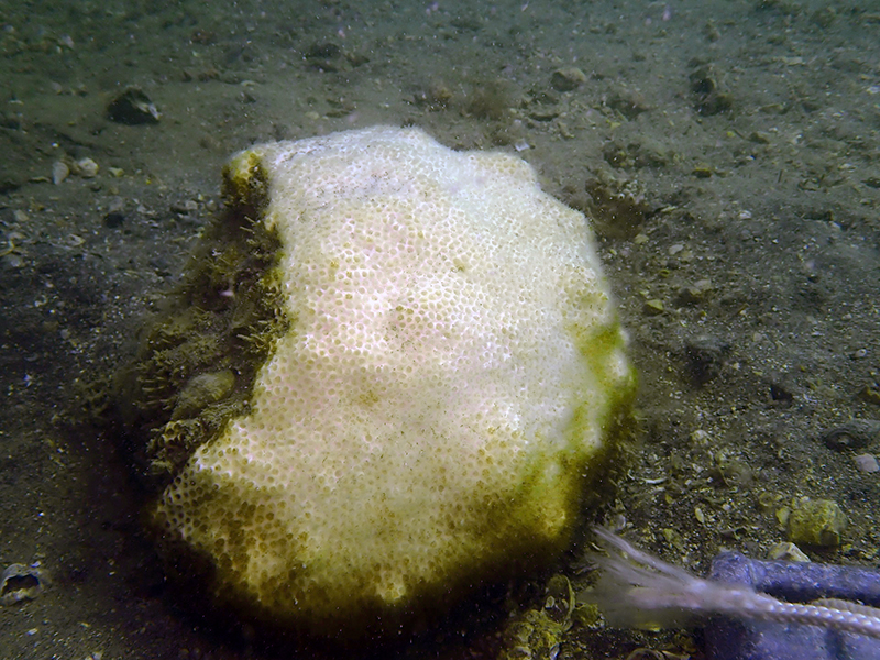
Limited high-resolution bathymetric data, patchy hard-bottom morphology, and uneven biological surveys have left major gaps in our understanding of where coral habitat exists. Without accurate habitat maps, conservation and restoration efforts risk overlooking resilient coral populations and potential climate refugia critical for long-term reef recovery.
Research Methods
Geospatial Data Integration
Compiled NOAA ENC bathymetry, USGS coastal geology, side-scan sonar mosaics, artificial reef databases, known ledge polygons, fisher-reported ledges, and verified coral occurrence records into a unified GIS framework.
Terrain and Habitat Modeling
Derived key environmental predictors, slope and rugosity, from bathymetric data to identify hard-bottom features and limestone ledges associated with coral settlement and persistence.
Depth-Stratified Analysis
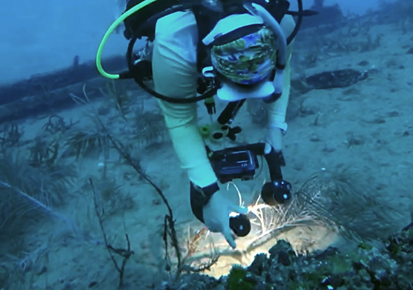
Analyzed habitats within the 0-40 m SCUBA-accessible depth range and subdivided results into three depth bands (0-10 m, 10-20 m, 20-40 m) to support safe, practical field validation and dive planning.
Hotspot & Suitability Mapping
Used weighted overlay analysis to generate a Habitat Suitability Index (HSI), then identified potential coral hotspots and cross-validated them using kernel density analysis and independent datasets.
Interactive Web Map Development
Created an interactive QGIS web map allowing researchers and restoration practitioners to visualize, filter, and export habitat data by depth, region, and suitability.
Key Findings
Coral records are heavily clustered in historically surveyed regions, while large data gaps persist in the Big Bend and Panhandle areas of the West Florida Shelf.
- Bathymetry, slope, and substrate complexity are strong predictors of coral habitat potential, with sharp differences among shelf ecoregions.
- Habitat-suitability modeling identified the central and southern WFS, and notably the Big Bend region, as promising areas for previously undocumented coral habitat.
- Incorporating fisher-reported ledges significantly improved model accuracy, demonstrating the value of local ecological knowledge in marine habitat mapping.
- The resulting interactive GIS map represents the first region-scale visualization of potential stony coral habitat across the eastern Gulf of Mexico at SCUBA-accessible depths, providing a practical decision-support tool for research, restoration, and genetic conservation planning.
Capstone Collaborator
Mote Marine Laboratory
Organization Mission: The advancement of marine and environmental sciences leading to new discoveries, revitalization, sustainability and greater public understanding of our oceans through innovative research, education, and outreach.
Dr. Erinn Muller
AVP for Research, Program Manager for Coral Health & Disease, and Senior Scientist
Partnering for Impact
“Shanell’s project focused on gathering critical information on the distribution of stony corals throughout the Gulf, which is an area that is often understudied. She compiled data from extensively different sources to create an incredibly informative GIS based tool that will help guide our collections for gene banking purposes. Without her effort we would not have the knowledge base necessary to preserve these corals for species preservation.”
Want to Share Your Story?
We want to showcase your work! Tell us about your project and get your moment in the spotlight.
