What is a GIS Analyst?
A Geographic Information Systems Analyst, or GIS Analyst, is a hybrid career of data analysis, cartography (map making) and programming. Put simply: A GIS Analyst is a mapmaker who uses technology to create a digital presentation of spatial and geographical information to build a database of information and create digital maps. In real-world practice, the data an environmental GIS Analyst compiles is used in everything from determining delivery routes to tracking the patterns of wildlife.
Originally, GIS databases were created only to assist cartographers and geographers. Today, they are valued in a variety of industries. Local, state, or federal government entities rely on GIS Analysts to map geographical plans. But nonprofit and private companies also require the specialized knowledge of a GIS Analyst, usually for environmental services and natural resource exploration and documentation.
Because it is a changing field that is technology dependent, environmental GIS Analysts work in an atmosphere of change and learning. Those interested in a career as a GIS Analyst can expect more growth and innovation as they make their mark on the field.
| Education Requirements | 4-Year Bachelor’s Degree |
| Recommended Degree Program | |
| Average Salary (2020) | $72,420 (for Cartographers and Photogrammetrists) |
| Employed in U.S. (2020) | 13,200 |
| Projected Jobs Added by 2030 | 700 |
| Projected Growth Rate | 5% |
| Other Job Titles | Cartographer, Mapping Technician, Photogrammetrists |
| Related Careers | Geographer, Data Scientist, Environmental Analyst |
Source: BLS, Occupational Outlook Handbook: Cartographers and Photogrammetrists, May 2020
What Does a GIS Analyst Do?
GIS Analysts are tech-savvy and have a wide skillset. To be a GIS Data Analyst, one should have strong problem-solving skills and the ability to think on their feet and multitask.
A GIS Analyst might focus on mapmaking, spatial analysis, or software development. Primary duties include using mapping software to analyze spatial data and design digital maps. GIS Analysts gather this information to make decisions about how land is utilized. They also anticipate and catalog geographic changes and maintain the digital databases that house geospatial information.
Besides fieldwork and analysis, GIS Analysts prepare reports and give their professional opinion to explain geographic trends and findings to clients. This means the profession requires excellent written and verbal communication skills.
Where Do GIS Analysts Work?
Many GIS Analysts enjoy being presented with new challenges almost daily. Some might spend much of their time in an office working standard business hours, though certain aspects of the job might require fieldwork to collect or verify data.
If an employer mainly provides GPS navigation, one GIS Analyst may be in the field collecting data while another is in the office setting up GPS navigation software. Many times, GIS Analysts will have a partnership with CAD drafters and technicians and will often report to a supervisor.
GIS Analyst: In the Field
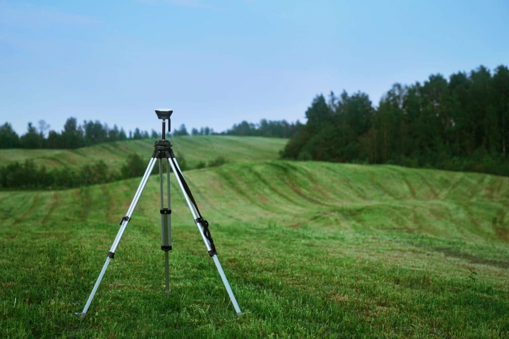
A portion of a GIS Analyst’s duties involves fieldwork – collecting and analyzing data to make geospatial decisions, which they then present to clients or coworkers. Using specialized equipment and instruments, GIS analysts might work outdoors and measure boundary lines or reconcile old and new measurements to update maps and software.
GIS Analysts: In the Office
Much of a GIS Analyst’s position involves maintaining and adding to a database of information and providing support to other departments that use GIS. Many new technologies in the GIS field make it unnecessary to visit a location to retrieve data, such as satellite imaging or remote sensing. Depending on the exact field or company a GIS Analyst works with, much of what they do might involve programming knowledge that primarily takes place in an office.

GIS Analyst Job Description
A typical GIS Systems Analyst generates custom and standard maps, spatial analyses and other GIS products to meet whatever customer requirements their company might require. They use tools and utilities to convert older, often outdated data to GIS formats and perform data quality checking and correction.
More experienced GIS Analysts might perform more complex professional duties to support their departmental systems, including importing, integrating, extracting and analyzing data for support purposes. They also develop trend analysis and forecasting models and may design, develop, or maintain more complex data layers and data sets.
Junior GIS Analyst Job Description
The first level GIS Analysts are responsible for carrying out a range of assignments to maintain the accuracy and quality of GIS data, developing products, and analyze data.
Examples of duties include:
- Perform data searches and retrievals
- Extract and organize data
- Research source documents to resolve missing or conflicting data
- Establishes map area and develop symbology using cartographic and design principles
- Overlay maps over aerial imagery to produce custom products and verify and correct geospatial data
- Perform standard spatial analyses such as buffering, spatial overlays and distance calculations
- Research and correct problems with data using spatial and logical analyses
- Convert spatial data from one coordinate system to another
- Geo-reference digital maps to align with real ground locations, using survey monument, GPS and other data as controls
- Participate in developing and implementing queries, scripts, and instructions of moderate difficulty
- Operate GIS-specific hardware including large format plotters and scanners
- Collect field data using GPS or other equipment
- Assist in training and mentoring newer GIS staff members
Senior GIS Analyst Job Description
Senior GIS Analysts work more independently than Junior Analysts and often perform more difficult assignments that require adapting conventional methods.
Examples of duties include:
- Meet with departmental staff to identify and analyze user requirements for GIS applications
- Work with internal customers and central agency staff in the planning, design, development, testing, and implementation of GIS applications
- Write reports suitable for both technical and non-technical audiences
- Manage project timelines and report the status of tasks to supervisors to ensure task completion within established timeframes
- Create highly customized maps and other products, such as complex queries to filter data and simple scripts
- Create geocoding services, monitor the processing steps, and perform quality control
- Create customized tools and menus for new and existing applications
- Write programs using development tools and programming languages
- Serve as the departmental business analyst or project leader
- Operates, maintains, troubleshoots and supports specialized GIS equipment
- Serves as a technical resource for other GIS staff; May lead a small team for training and mentorship
The Average U.S. Salary for a GIS Analyst
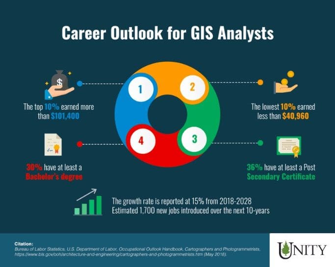
The U.S. Bureau of Labor Statistics (BLS) classifies GIS Analysts among Cartographers and Photogrammetrists. As of 2020, the BLS reported a median salary for Cartographers and Photogrammetrists at $68,380 per year or $32.88 per hour – up from $64,430 per year in 2018.
The national average for a Junior GIS Analyst salary range is typically around $40-$50k per year, depending largely on experience level, job duties, and area of employment. A senior GIS Analyst salary, for someone who might be considered a project manager, developer, or engineer, is around $88-$108K annually.
What Is the Job Demand for a GIS Analyst?
The BLS, again classifying GIS analysts among cartographers and photogrammetrists, projects an employment increase of 5 percent from 2020 to 2030. This growth rate is slightly below average for all occupations in the nation.

In the United States, California, Texas, and Virginia had the highest number of job postings for GIS Analysts. Northern Colorado’s cluster of GIS career opportunities has earned the region the nickname “GIS Alley.” It’s well known in the community for its early involvement in geospatial technology.
What Qualifications do you need to be a GIS Analyst?
GIS Analysts are required to hold a bachelor’s degree in either Computer Science, Geography, Geoscience, Surveying, Engineering, or a related field. Many entry-level positions do not require prior experience to apply, but some might require 1-5 years of related work experience or a GIS analyst internship. GIS Analyst qualifications can vary by region or position type.
Typical Requirements For a GIS Analyst Include:
- Proficiency with database programming languages such as SQL, R or Python
- Proficiency with front-end design languages such as HTML, CSS, JavaScript and various mapping languages
- Experience with mapping tools such as QGIS and Carto
- Experience with GPS measuring tools
- Outstanding quantitative skillset
- Attention to detail and good problem-solving skills
- Analytical mindset
- Excellent written and verbal communication
- Good interpersonal skills
GIS Analyst High School Recommendations
Requirements for a career in Geographic Information Systems analysis might depend on your particular area of interest – especially when thinking about early developmental education paths. Relevant high school subjects might include computer science, earth science, geography, or wildlife education.
Extracurricular activities that can help a candidate stand out include 4H, technology or science-based applications. Clubs that promote interpersonal skills like speech, debate, and student council are also recommended.
GIS Analyst College Education Requirements
Do you need a degree to be a GIS Analyst?
GIS analysts usually have a Bachelor’s or Master of Science degree in geography, computer science, surveying, engineering, forestry or earth science. It’s often worth considering specialized courses such as GIS or mapping to get started. Other primary focuses are environmental science, statistics, cartography, remote sensing, and geography.
Many career paths in the GIS field do not require a master’s degree. Most entry-level jobs provide special experience or specialized on-the-job training to hone specific skills, but should you have a specific career path in mind. A master’s degree in GIS might be the right choice to accelerate your career path.
How long does it take to become a GIS Analyst?
A bachelor’s degree typically takes four years to complete, while a master’s degree in environmental GIS will require an additional 2-years. Many entry-level positions don’t require experience. But, if you are seeking a more advanced career path, having at least 2-4 years of GIS-related history can give you an edge over the competition.

Ready To Learn More About Unity Environmental University?
Related Degrees
- Geoscience – Both in the lab and out in the field, this minor covers landform evolution, erosion and sedimentation, water quality, Geography Information Systems, and more.
- Database Management – This path explores databases in companies and organizations and emphasizes the newest tech industry advancements in productivity.
- Environmental Geographic Information Science – This is an advanced degree that covers vital topics in GIS such as using geoprocessing tools and data analysis.
- Land Surveying/Cartography – These degrees provide a broad overview of how land is spatially organized, connected, and mapped.
Additional Certifications and Licenses
Some states require surveying licensure for all cartographers and photogrammetrists, though for a GIS Analyst, this is not always the case. Overall, GIS Analysts with certification can earn higher salaries than those who are not certified.
The GIS Certification Institute (GISCI) is an especially popular institution that offers a certificate program for experienced GIS professionals. To take part in continuing education, applicants must meet educational and professional standards as well as pass written examinations.
Societies and Professional Organizations for GIS Analysts
The Association for Geographic Information
A UK based organization that promotes networking opportunities and connecting the GI community.
Cartography and Geographic Information Society (CaGIS)
A collection of educators and researchers involved in design, creation, and use of geographic technologies and information.
Geospatial Information & Technology Association (GITA)
A professional community with goals of enriching the geospatial community through education, connection, and advocacy.
GIS Certification Institute (GISCI)
A nonprofit organization that offers licensing and continued education for GIS professionals.
Management Association for Private Photogrammetric Surveyors (MAPPS)
An organization that focuses on the business aspects of surveying, mapping, remote sensing and GIS.
Urban and Regional Information Systems Association (URISA)
URISA provides outreach for geospatial challenges and issues and resources for GIS professionals throughout their GIS analyst career.


